Maps can represent a lot of different things. To me, the goal of a good map is to tell a good story, one worth telling. I’ve always liked to say to my clients that “Pictures may tell a thousand words, but good a map will tell a million”, (who said it other than me I have no idea). Why so many words? Because a map is giving information to its audience at every square inch of its creation. And yes, I’m passionate about maps.
Up until now in my life I have mostly spent my years toiling away using cartography to tell stories about human activities on the landscape. To break down our complex spatial activities into a single snap shot that explains everything as clearly as possible. Sometimes this is easy “Where is a x in relation to y”, sometimes this is very difficult “what are the human anthropogenic effects in the northern arctic”. But every map has a story and you will make a better one if you can figure out what it is. Once you know your story, you can lean all the elements to focus the audiences attention on that specific story. Ensure the story isn’t being distracted by other map elements, place the colour/symbol emphasis on the lead characters etc..
So when Will Hindmarch asked me to create a map of a fictional city for his game “Project: Dark” I knew I needed that story first. I have made the odd simple map for my own games in the past, but I had never done fictional cartography on the scale that Will was asking. But in the end, a fictional map is still just a map, and every map has a story to tell, what story does the City on the Saturnine need to tell?
So I asked some questions to find out what this map was supposed to do, what story did Will want to tell? The questions varied from technical to artistic. In our discussions we always kept coming back to the theme of the game, a dark city of thieves and how so much of play is based on the spaces between, the alleys, the streets, the spaces between light and dark. The map needed the streets to tell stories of how the city was shaped over time, of how the old walls were built over as the city expanded time and time again. Ultimately the City on the Saturnine would grow into a true urban jungle.
These discussions led Will to draw me a sketch and provide me with some words on what each area of the city should represent in the game. What story should each section of the city tell to the audience.
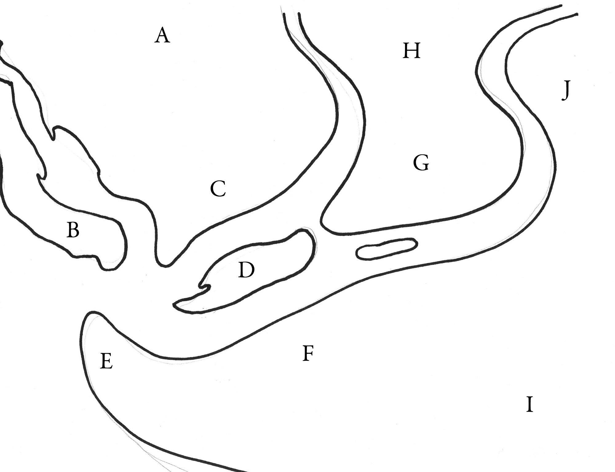 We all have to start somewhere, and a simple sketch is the start of every great piece of art. The sketch and the discussions that blossomed from it began to tell a story of how the city began in area G “the old city” where the Queen dwells in a keep and a series of bustling, over crowded streets move out in radial patterns towards the edges of the Labyrinthine River (Middle) and Saturnine River (East) where huge stone towers and old massive walls were once built to contain and protect the city. Over time these walls gave way as the city expanded out into the Highlands of H, and the Riverbank of F. There the city simmered with its new walls, until once again it burst out and occupied the Island of D, constructed a huge port at E and eventually bled into the “New City” of C and the Labyrinthine Canals of A. The city was always expanding until it met the mountains to the north, east and south and then the sea to the west.
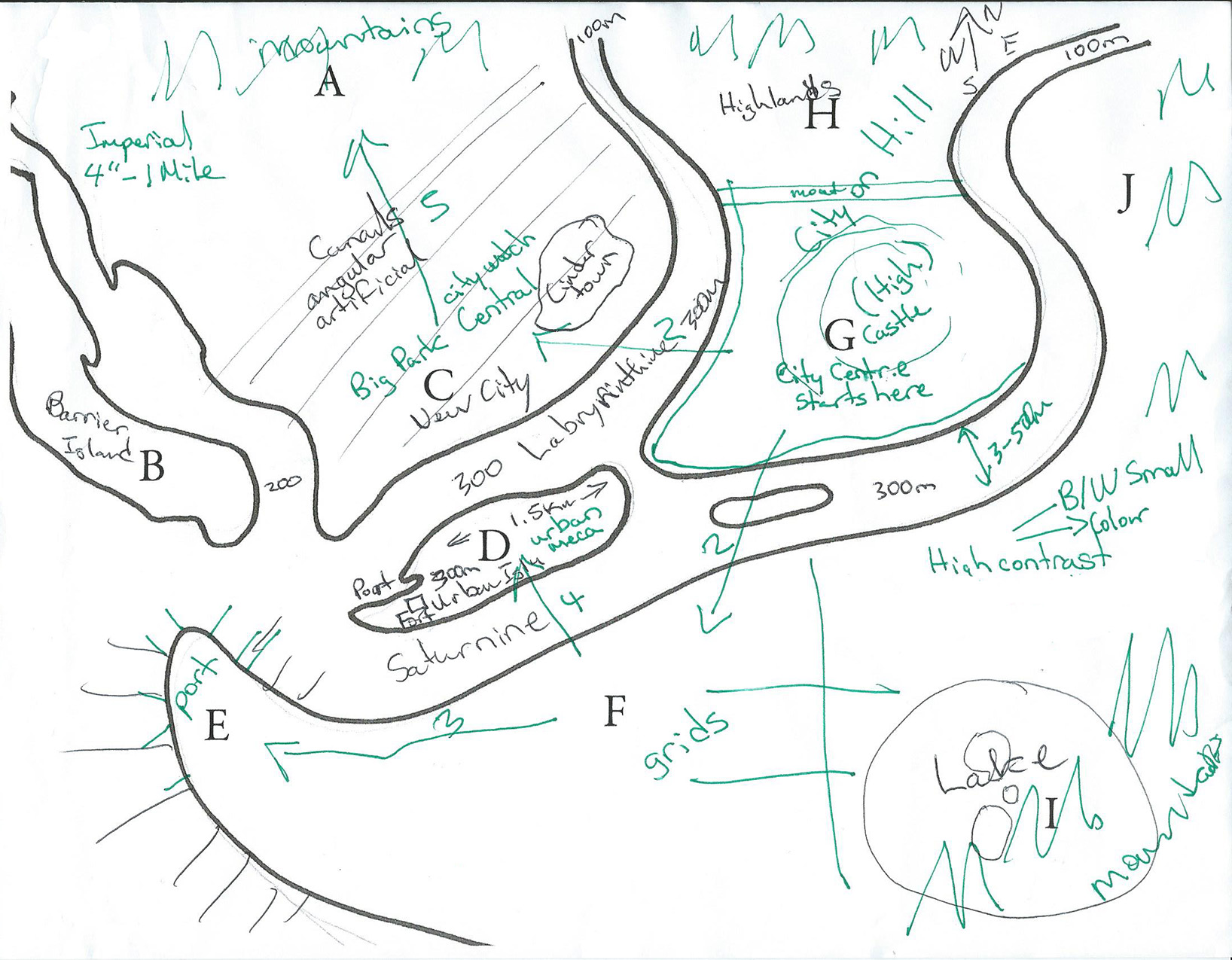
My notes led to this sketch on top of Wills and yes I know it’s awful. The key reason I’m sharing it is because I’m using it to go back to the story Will wants to tell. The green arrows and numbers are at the heart of this cities story, in the order of the numbers 2 to 5 the city expands but changes its nature each time.
These discussions, notes and sketches are the first step in the next few months as I journey to create THE CITY ON THE SATURNINE… and you are all welcome to follow along. Next time we will look at questions of scale, how big is too big and how the city of Chicago is going to help me with that conundrum.
-Mark